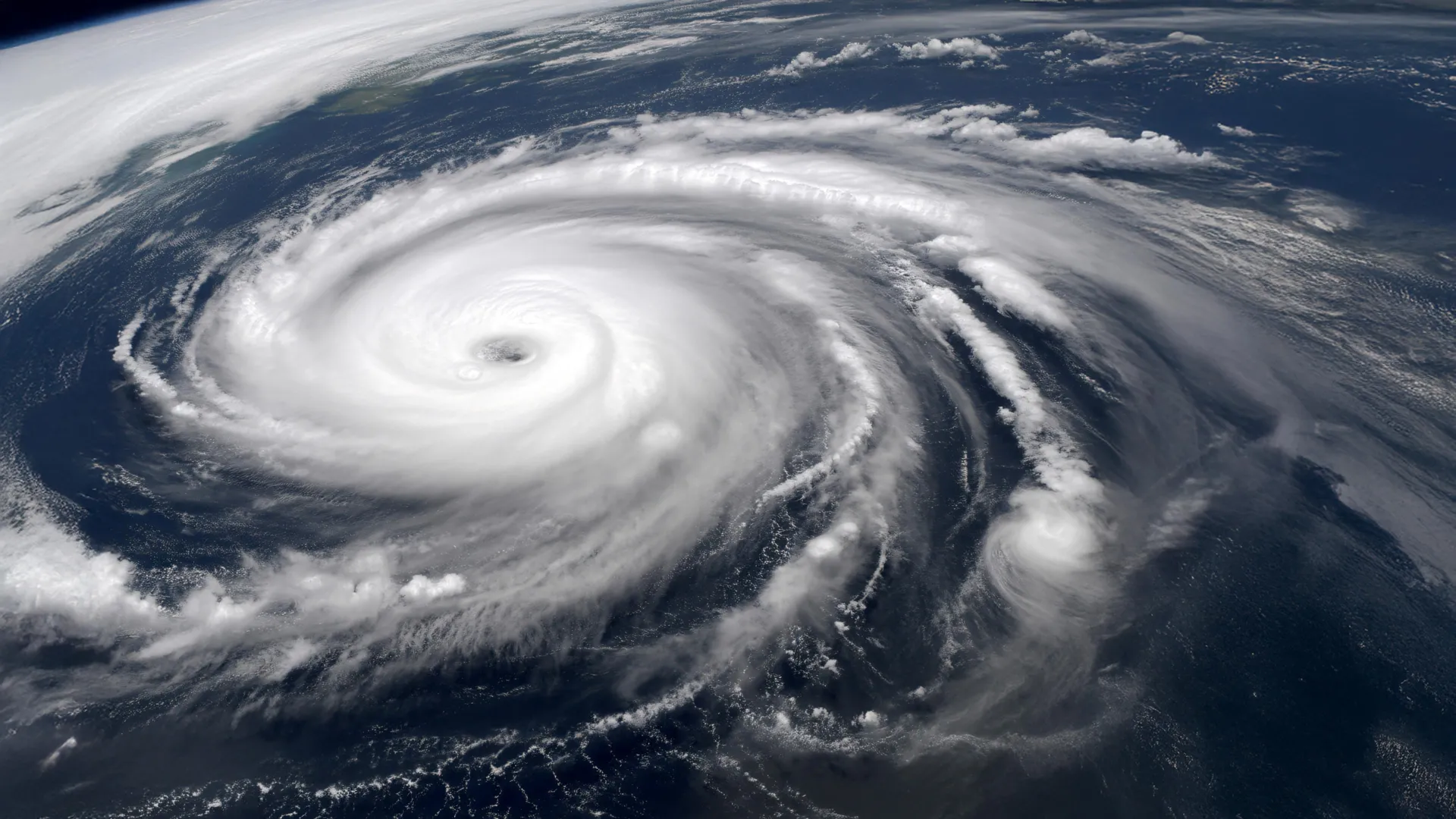
Oceans are supercharging hurricanes past Category 5
Warming oceans are fueling a surge of extreme, off-the-charts storms—so powerful that scientists say it’s time to invent a whole new hurricane category.
- Date:
- December 25, 2025
- Source:
- American Geophysical Union
- Summary:
- Deep ocean hot spots packed with heat are making the strongest hurricanes and typhoons more likely—and more dangerous. These regions, especially near the Philippines and the Caribbean, are expanding as climate change warms ocean waters far below the surface. As a result, storms powerful enough to exceed Category 5 are appearing more often, with over half occurring in just the past decade. Researchers say recognizing a new “Category 6” could improve public awareness and disaster planning.
- Share:
Ocean regions that fuel the planet's most powerful hurricanes and typhoons are heating up in the North Atlantic and Western Pacific. These changes are being driven not just by warmer surface waters, but by heat that now extends far below the ocean surface. New research suggests that human-caused climate change may account for as much as 70% of the expansion of these storm-forming hot spots.
As these hot spots grow, they increase the likelihood that exceptionally intense tropical cyclones, sometimes described as Category '6' storms, could make landfall near heavily populated coastlines.
"The hot spot regions have expanded," said I-I Lin, a chair professor in the Department of Atmospheric Science at the National Taiwan University.
Lin shared the research during an oral presentation focused on tropical cyclones at AGU's 2025 Annual Meeting in New Orleans, Louisiana.
Why Scientists Are Calling for a New Storm Category
Lin has studied the most extreme hurricanes and typhoons for more than ten years. Her work intensified after Typhoon Haiyan -- also known as Super Typhoon Yolanda -- struck the Philippines at peak strength in November 2013, killing thousands of people. In 2014, Lin and her colleagues published research in the AGU journal Geophysical Research Letters arguing that storms of this magnitude warrant a new classification, Category 6.
Under their proposal, Category 6 tropical cyclones would include storms with wind speeds exceeding 160 knots. Until now, any storm stronger than 137 knots has been grouped into Category 5, which most weather agencies still consider the highest level. Lin noted that most hurricane categories span a range of about 20 knots, making a separate Category 6 more consistent with how storms are classified. Category 4, for example, includes winds between 114-137 knots.
The Strongest Storms on Record
Several well-known storms would fall into this proposed Category 6. Hurricane Wilma in 2005 remains the most intense hurricane ever measured in the Atlantic basin. Typhoon Haiyan also meets the criteria, as does Typhoon Hagibis, which hit Tokyo in 2019. Hagibis caused enormous damage from rain and wind, Lin said, even though the storm had weakened somewhat before reaching the city.
Another standout example is Hurricane Patricia, which developed in the Pacific Ocean off Mexico's coast. Patricia holds the record as the strongest tropical cyclone ever observed, with winds reaching up to 185 knots -- powerful enough to qualify as a Category 7 storm, if such a category existed, Lin said. "Patricia was the king of the world," she added.
Burgeoning ocean hotspots feed big storms
To understand how often these extreme storms occur, Lin and her team reviewed records of major tropical cyclones from roughly the past 40 years. Their analysis shows that storms exceeding 160 knots are appearing more frequently. Between 1982 and 2011, eight such storms were recorded. From 2013 to 2023, that number rose to 10.
In total, 18 Category '6' storms have occurred over the past four decades, with more than half forming in just the most recent decade.
Where the Most Dangerous Storms Are Forming
Lin's ongoing research, which she discussed at the American Geophysical Union's 2025 Annual Meeting, shows that nearly all Category '6' tropical cyclones develop within specific ocean hot spots. The largest of these lies in the Western Pacific, east of the Philippines and Borneo. Another major hot spot stretches across parts of the North Atlantic near and east of Cuba, Hispaniola and Florida.
The study also found that these hot spots are expanding. In the North Atlantic, the region has spread eastward beyond the northern coast of South America and westward into much of the Gulf. The Western Pacific hot spot has also increased in size.
Why Deep Ocean Heat Makes Storms Stronger
The defining feature of these hot spots is not just warm surface water, but unusually deep layers of heat beneath the surface. In many parts of the ocean, strong storms stir up cooler water from below, which can weaken the storm. In hot spot regions, however, warm water extends so deep that storms do not cool as easily.
Even so, Lin emphasized that warm ocean conditions alone do not guarantee the formation of a Category '6' storm. Atmospheric conditions must also align. "The hot spots are a necessary but not sufficient condition," she said.
Climate Change Plays a Major Role
The researchers examined what is driving the expansion of these deep warm-water regions and found that both natural temperature cycles and long-term warming contribute. However, their analysis suggests that human-caused climate change is responsible for roughly 60-70% of the growth of these hot spots. This expansion, in turn, increases the likelihood of Category '6' tropical cyclones.
Lin said that formally recognizing Category '6' storms could help governments and communities better prepare for future impacts, especially in regions where these extreme systems are becoming more common. "We really think there is a need just to provide the public with more important information," Lin said.
Story Source:
Materials provided by American Geophysical Union. Note: Content may be edited for style and length.
Cite This Page: